The medieval town
Just 10 km from the Clair de Lune campsite in Hyères, the old town is the most medieval of the city. According to historians, Olbia’ s tribes once inhabited the hill, which was fortified by natural fortifications.

The Saint Paul gate
The Porte Saint Paul is located in the heart of the old town, near the Collégiale Saint Paul. It is one of the gateways to the upper part of the town, through the second city wall.
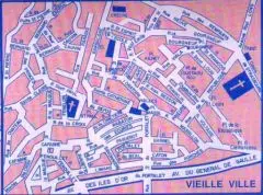
With its castle, Hyères was once a fortified town, and its defense consisted of three enclosures: the first encircled the castle, the second protected the upper town, and the third extended as far as today’s harbor square. At the time, the city’s defensive walls consisted of three enclosures.
The first, very small, encircled the old castle. It had two gates, one inside, and two round defensive towers. This was the castle’s main entrance, facing the town. The other, outside, faced west, across the countryside towards Toulon. This gate was fortified by a round tower, located at the end of a structure that protrudes significantly from the ornament of the main wall. This tower undoubtedly served as an observation post and guardhouse. It is thought to have had a cistern base.
The second enclosure, to the east of the first, accessed the gateway known as la souguette or le Pierrefeu. It stood above the St-Bernard convent, but was later demolished by the Commune. From here, it descended southwards, skirting the convent: then, a little further south-west, it joined the porte de Balue or Barue, then the esplanade de la Barbacane to the porte St-Paul, where it almost merged with the wall of the building. From here, there was just one wall, but it no longer exists, which ran down to the west, between the church and the former Curie Royale, joining Rue Cafabre, then reaching the gate of that name. From here, the enclosure ran northwards to the Porte St-Jean. Nearby, the second wall merges with the first. As for the third, it was fortified by square towers, serrated from distance to distance at the top.
The third enclosure still retains its walls and towers at several points. Starting at the Porte Cafabre, it descended to the Rue de Limans, following its line to the Porte du Fenouillet, next to which the mills’ beal entered the town. It then reached the Porte du Portalet, where the Piquet municipal tax office was located. The enclosure then ran along the rue des Porches to the Porte de la Rade or Grand-Portail; from here, it climbed up to the Cordeliers convent, which it followed to the Saint-Louis church, with which it merged; From here, it went to a final gate called Porte-Neuve or portail-Neuf, which stood at the junction of rue du cimetière (now rue de la République), rue Neuve-de-Bourgneuf and place du Jeu de Ballon, next to a tower that stood at the bottom of the rue du rempart; from here, the wall went to the convent of St-Bernard, where it joined the second enclosure.
Castel Sainte-Claire
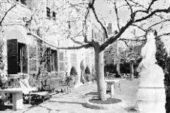
Castel Sainte-Claire is the former convent of the same name, which was built in the 17th century and became national property in 1793. Built in the neo-Romanesque style after 1869 by Olivier Voutier (1796-1877), a sailor and archaeologist, supporter of Greek independence and explorer who discovered the Venus de Milo, it is surrounded by two fancifully serrated towers.
It was home to American writer Edith Warhton from 1927 to 1937.
The town of Hyères recovered it in 1955 and commissioned David, an architect from Hyères, to change the main façade. The Port-Cros National Park leased the building in 1900 and transformed the park into a botanical garden.

The harbor gate
The Porte de la Rade opens onto Rue Massillon, a shopping street where you’ll find fishmongers, cheesemongers, butchers, fresh food shops… This street leads up to the Templiers tower.
The Templar Tower
The Tour des Templiers or Tour Saint-Blaise is the only legacy of the ancient Templars, who lived in Hyères from the end of the 12th to the beginning of the 16th century.
History
In 1198, we first hear of a temple house in Hyères and of Jordan, its commander. In the 13th century, the tower was part of a complex comprising a cazal (estate bordered by arable land) and numerous outbuildings: stables, oven, forge, granary, etc. These were built around a large rock called the piol, on which the tower was built, and which remained standing until the 19th century.
The House of the Temple of Hyères owned land, woods and meadows; vineyards and olive groves… located close to the town, in the Bormettes district, or in the Sauvebonne valley for a large part of the arable land. It was indeed a large agricultural estate.
Like all such houses, it supplied equipment, wheat, fodder, money, horses and men. But also soldiers from Spain and the Holy Land. Nevertheless, it is highly probable that it was attributed to a port activity via the Templar installations in Toulon.
The Templars were land managers. In the early years of the 13th century, the House of Temple in Hyères was able to supply Count Alphonse II with large quantities of wheat.

Thereafter, until the abolition of the Order of the Temple, there are no records of the House of Hyères’ assets or activities. We have barely found any information on its commanders, Bertrand de Gardanne (1213), Isnard Ricard (1236), Lambert (1256) and Guillaume Dalmas (1271).
That said, 14th-century documents confirm that the Templar lands were perfectly well managed. What’s more, the existence of the Temple’s buildings outside the city walls had a lot to do with the structuring of the Bourg-neuf, and the location of the tower even served as an advanced defense of the city and its accesses.
At the end of the 13th century, after the fall of Saint-Jean d’Acre (1291), the Templar order declined. The houses of Hyères and Péirassol were brought together under a single commander, Raymond des Angles. In January 1308, during the general imprisonment of the Templars in Provence, the list for the house of Hyères contained just three names apart from that of the commander.
After the abolition of the Order of the Temple, Saint-Jean-de-Jérusalem recovered its property. In Hyères, they were managed by the Hospitaller Commandery of Beaulieu (near Solliès), which initially rented them out to private individuals. In 1673, however, they were given to the town under an emphyteutic lease, with an annual rent of 210 pounds. The chapel was donated to the Blue Penitents until 1765, when the commune converted it into a rest area. In 1769-1770, an intermediate level was added, with the destruction of the vaults and the addition of an interior staircase.
After these renovations, the chapel continued to house stores, the upper room was transformed into an attic, and the newly-built intermediate level was used as a meeting room by the town council, which sat there until 1913.
Rue des Porches
It is considered to be the open space surrounding the inner face of the enclosure and, in Aix and Avignon, is still known as “rue des Lices”.
The foundations that cross it and have made it famous only date from the 18th century, when the enclosure was transformed by housing.
Carried by barrel vaults or cross vaults, they then gain in habitable volume, sometimes linking the two sides of the street.
Rue du Repos
Its banks are surrounded by fractions of facades used as retaining walls for courtyards and gardens.
The largest ruin is located on the right as you climb towards St-Paul. This neat foundation, a small installation with a corner chain as its base, undoubtedly dates from the 14th century and is the first level of the corner of a dwelling advancing along a street line, whose arched entrance door faces the slope.
On its south face, four stone corbels highlight the existence of an awning or storey.
Bourgneuf Street
This is one of the small streets in the old town, between Rue Neuve and Rue du Trou de Laser, leading up to the castle.
Place de la République
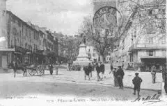
Behind the statue of Massillon lies the Place de la République. Shaded by two rows of plane trees, the square is lined with attractive facades dating from the first half of the 19th century, featuring bay windows, carved doors and balconies with wrought-iron railings.


